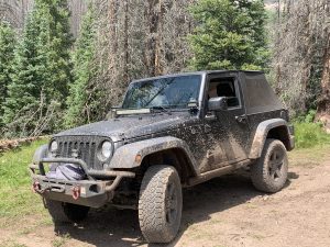
 OHV Permit
Remember, before hitting an offroad trail in Colorado make sure you have a current OHV permit. They are only $25.25 and can be purchased at various stores in South Fork. For more information see Colorado Parks and Wildlife website.
Directions
The Wheeler Geologic Area route begins at the East Bellows Trailhead. To get to the start of this route, follow Hwy 149 northwest from South Fork to Pooltable Road, about 12 miles. Follow Pooltable Road (US Forest Service Rd 600) 10 miles to the trailhead.
The Route
This 4×4 Overland route is classified as moderate and covers a distance of 14 miles from the trailhead. At the beginning of the trail, you will pass through a pine forest with both live and dead trees. You may notice some logging or firewood harvesting on either side of the track. As you climb from the trailhead, you will cross East Bellow Creek at the 4-mile mark and reach the high point of 11,447 feet at 4.5 miles. After passing the 6.9-mile mark, the track crosses Cañon Fernandez and then descends to cross Cañon Nievo Creek at 9.6 miles. From the creek crossing, the trail climbs again to the 12.5-mile mark before descending to the Wheeler Geologic Area.
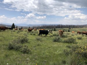 As you navigate this trail, besides trees, mountains,
 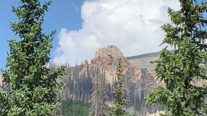 and open range cattle can be seen grazing. The Cattle stand or sit peacefully and appear to be used to the vehicles that pass by.
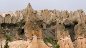
After a short hike down the trail at Wheeler Geologic Area, visitors can see the impressive hoodoos. These spire and column-shaped formations have been created by thousands of years of erosion.
Below are video clips of the Wheeler Geological area 4×4 route.